


17 April 2026
for Madrid Nuevo Norte



'/%3E%3Cpath fill='%23F71013' d='M133.063 1v5.769L126.337 1h-12.944v5.77L106.667 1H93.723v5.77L86.997 1H73v61h15.937v-5.77L95.663 62h12.944v-5.77l6.726 5.77h12.944v-5.77l6.726 5.77H149V1z'/%3E%3Cpath fill='%23FFF' d='M99 15v9h-2.209v-7.689l-.499 2.109L94.425 24h-2.85l-1.867-5.58-.5-2.07V24H87v-9h3.905l1.61 5.194.485 1.967.485-1.954L95.095 15zM105.818 20.513c0-1.13-.579-1.655-1.81-1.655-1.188 0-1.752.525-1.752 1.655 0 1.104.564 1.63 1.751 1.63 1.232 0 1.811-.526 1.811-1.63zM108 17.135v6.73h-2.256v-1.507c-.416 1.063-1.262 1.642-2.45 1.642-2.122 0-3.294-1.4-3.294-3.487C100 18.4 101.113 17 103.146 17c1.262 0 2.168.592 2.598 1.696v-1.561H108zM114.818 20.352c0-1.183-.579-1.732-1.81-1.732-1.188 0-1.752.55-1.752 1.732 0 1.155.564 1.704 1.751 1.704 1.232 0 1.811-.549 1.811-1.704zM117 14v9.86h-2.256v-1.578c-.416 1.112-1.262 1.718-2.45 1.718-2.121 0-3.294-1.465-3.294-3.648 0-2.211 1.113-3.676 3.146-3.676 1.262 0 2.168.62 2.598 1.775V14H117zM122 17.11v1.943c-.328-.11-.541-.138-.94-.138-.997 0-1.895.496-1.895 2.37V24H117v-6.89h2.165v1.957c.157-1.006.627-2.067 1.966-2.067.228 0 .584 0 .869.11'/%3E%3Cmask id='89zww8pfdd' fill='%23fff'%3E%3Cuse xlink:href='%231de91x7csc'/%3E%3C/mask%3E%3Cpath d='M123.208 24h1.584v-6.685h-1.584V24zM123 15.203c0-.775.354-1.203.99-1.203.645 0 1.01.428 1.01 1.203 0 .802-.365 1.244-1.01 1.244-.636 0-.99-.442-.99-1.244zM131.818 20.352c0-1.183-.579-1.732-1.81-1.732-1.188 0-1.752.55-1.752 1.732 0 1.155.564 1.704 1.751 1.704 1.232 0 1.811-.549 1.811-1.704zM134 14v9.86h-2.256v-1.578c-.416 1.112-1.262 1.718-2.45 1.718-2.122 0-3.294-1.465-3.294-3.648 0-2.211 1.113-3.676 3.146-3.676 1.262 0 2.168.62 2.598 1.775V14H134zM96 27v9h-2.865l-3.382-5.477-.559-1.144V36H87v-9h2.977l3.158 5.104.67 1.26V27zM105 30v6.863h-2.19v-1.551c-.345 1.125-1.094 1.688-2.275 1.688C98.821 37 98 36.026 98 34.008V30h2.19v3.884c0 .838.403 1.222 1.21 1.222.863 0 1.41-.535 1.41-1.77V30H105zM108.216 32.813h2.68c-.014-.982-.435-1.319-1.29-1.319-.856 0-1.277.377-1.39 1.32m4.77 1.332h-4.77c.127.916.576 1.293 1.473 1.293.674 0 .996-.202 1.333-.849l1.824.62c-.477 1.157-1.53 1.79-3.213 1.79-2.174 0-3.633-1.373-3.633-3.446 0-2.127 1.431-3.554 3.563-3.554 2.062 0 3.437 1.373 3.437 3.446 0 .229 0 .404-.014.7' fill='%23FFF' mask='url(%2389zww8pfdd)'/%3E%3Cpath fill='%23FFF' mask='url(%2389zww8pfdd)' d='m120 30-2.72 7h-2.56L112 30h2.399l1.608 5.18 1.595-5.18zM125.765 33.513c0-1.13-.56-1.655-1.765-1.655-1.206 0-1.765.525-1.765 1.655 0 1.104.559 1.63 1.765 1.63s1.765-.526 1.765-1.63m2.235 0c0 2.168-1.823 3.487-4 3.487s-4-1.32-4-3.487c0-2.18 1.823-3.513 4-3.513s4 1.333 4 3.513M96 40v9h-2.865l-3.382-5.477-.559-1.144V49H87v-9h2.977l3.158 5.104.67 1.26V40zM102.765 45.513c0-1.13-.559-1.655-1.765-1.655s-1.765.525-1.765 1.655c0 1.104.559 1.63 1.765 1.63s1.765-.526 1.765-1.63m2.235 0c0 2.168-1.823 3.487-4 3.487s-4-1.32-4-3.487c0-2.18 1.823-3.513 4-3.513s4 1.333 4 3.513M110 42.11v1.943c-.327-.11-.541-.138-.94-.138-.997 0-1.895.496-1.895 2.37V49H105v-6.89h2.165v1.957c.157-1.006.627-2.067 1.966-2.067.228 0 .584 0 .869.11M114.18 43.88v3.264h1.688V49h-1.451c-1.346 0-2.243-.949-2.243-2.372v-2.749H111v-1.856h1.174V40h2.005v2.023H116v1.856h-1.82zM119.216 44.814h2.68c-.014-.983-.435-1.32-1.29-1.32-.856 0-1.277.377-1.39 1.32m4.77 1.332h-4.77c.127.916.576 1.293 1.473 1.293.674 0 .996-.202 1.333-.849l1.824.62c-.477 1.157-1.53 1.79-3.213 1.79-2.174 0-3.633-1.373-3.633-3.446 0-2.127 1.43-3.554 3.563-3.554 2.062 0 3.437 1.373 3.437 3.446 0 .23 0 .404-.014.7'/%3E%3C/g%3E%3C/svg%3E)

In recent years, the idea of the “15-minute city” has gained popularity: neighbourhoods where most daily needs—basic shopping, education, green spaces and local services—are within walking or cycling distance. Although the concept is often presented as an innovative proposal, its roots actually date back almost a century.
As early as 1929, the American urban planner Clarence Perry formulated the concept of the neighbourhood unit, a basic building block of the city designed to facilitate the daily lives of its inhabitants. His proposal was based on a simple but powerful idea: organising the city around human distances, walkable on foot. According to Perry, a neighbourhood unit should house between 5,000 and 9,000 inhabitants and be traversable on foot in about five minutes, equivalent to approximately 400 metres. Essential everyday services were concentrated within it, while several neighbourhood units grouped together to form a larger scale, which he called a “vital zone”. This structure sought to strengthen community life, reduce unnecessary trips and make the city more comprehensible and liveable for its residents.
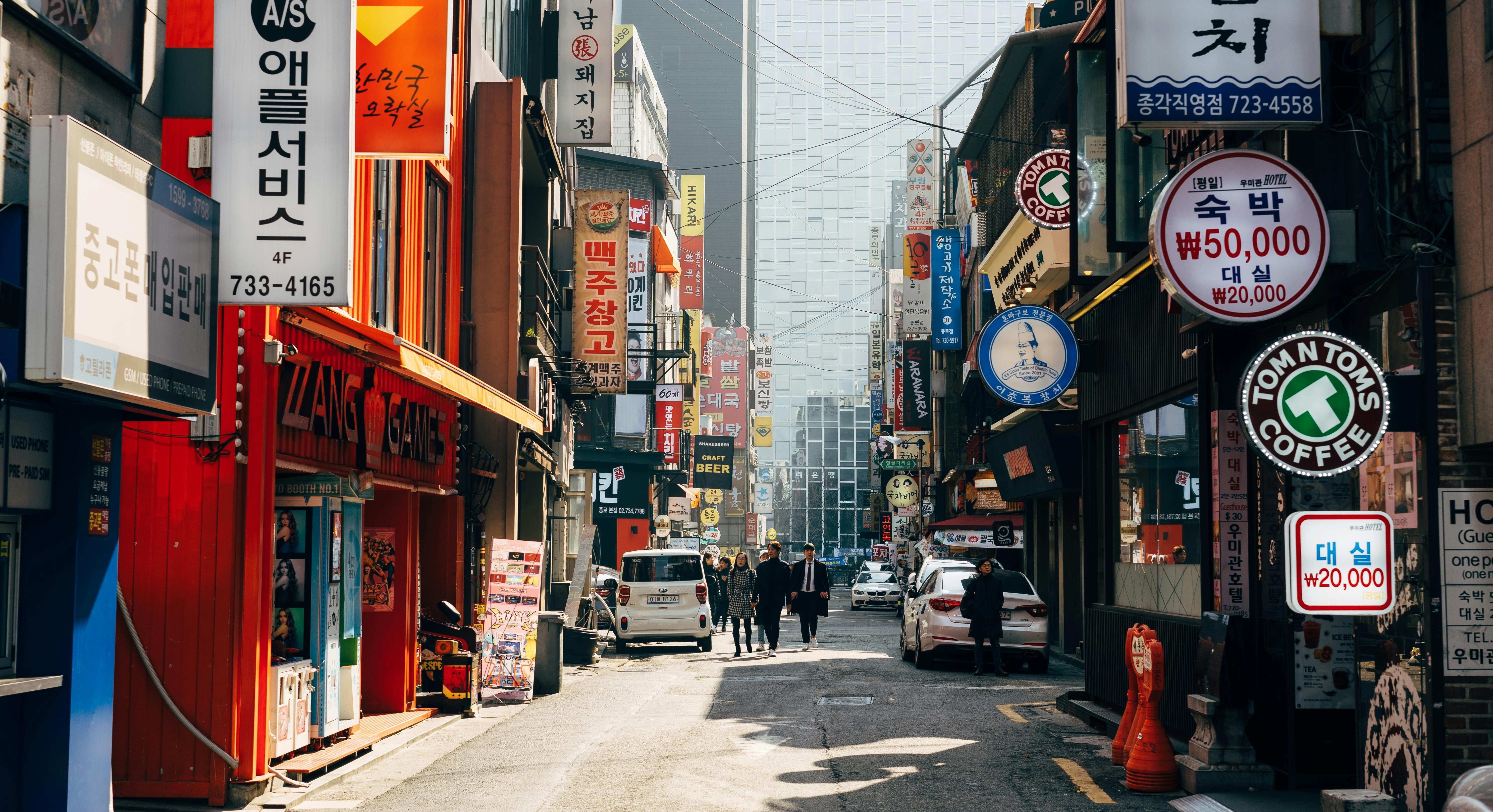
Decades later, these ideas found very concrete applications in different urban contexts. An illustrative example is the development of neighbourhoods in the 1970s and 1980s in Seoul, following the logic of vital zones and directly inspired by Clarence Perry’s idea.
For example, the functional diagram of the Mok-Dong neighbourhood (1983) shows how several neighbourhood units were articulated together to form a coherent urban ensemble, with facilities distributed systematically and routes designed for pedestrians. These units prioritised pedestrian movement and were bounded on their periphery by arterial roads for vehicular traffic. This model was promoted in a context of strong demographic growth and rapid urban development in South Korea, and left a lasting mark on the way cities were built. This approach to spatial planning allowed them to organise large urban areas according to a single set of criteria, although the evolution of land uses within those neighbourhoods eventually generated challenges in the South Korean capital associated with the excessive specialisation of certain areas and the emergence of urban barriers between residential “islands”.
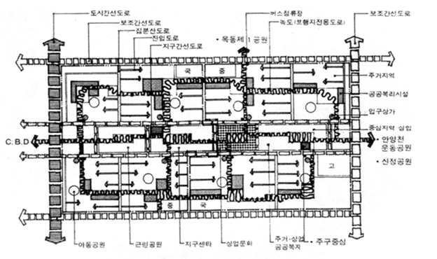
Plan of the Mok-Dong neighbourhood (1983), in Seoul, with local facilities and pedestrian routes. Source: Korean Housing Corporation/Marc Brossa
Recent studies, as well as public reflection and debate on these ideas, consider that proximity is undoubtedly a necessary condition for a good quality of urban life, but not sufficient on its own. There are services, opportunities and facilities—universities, leading hospitals, major cultural centres, metropolitan parks or centres of economic activity—which, by their very nature, cannot and should not be within a 15-minute walk of every home across the region. The key, then, is not to replicate all of that in every neighbourhood, but to connect the different parts of the city effectively.
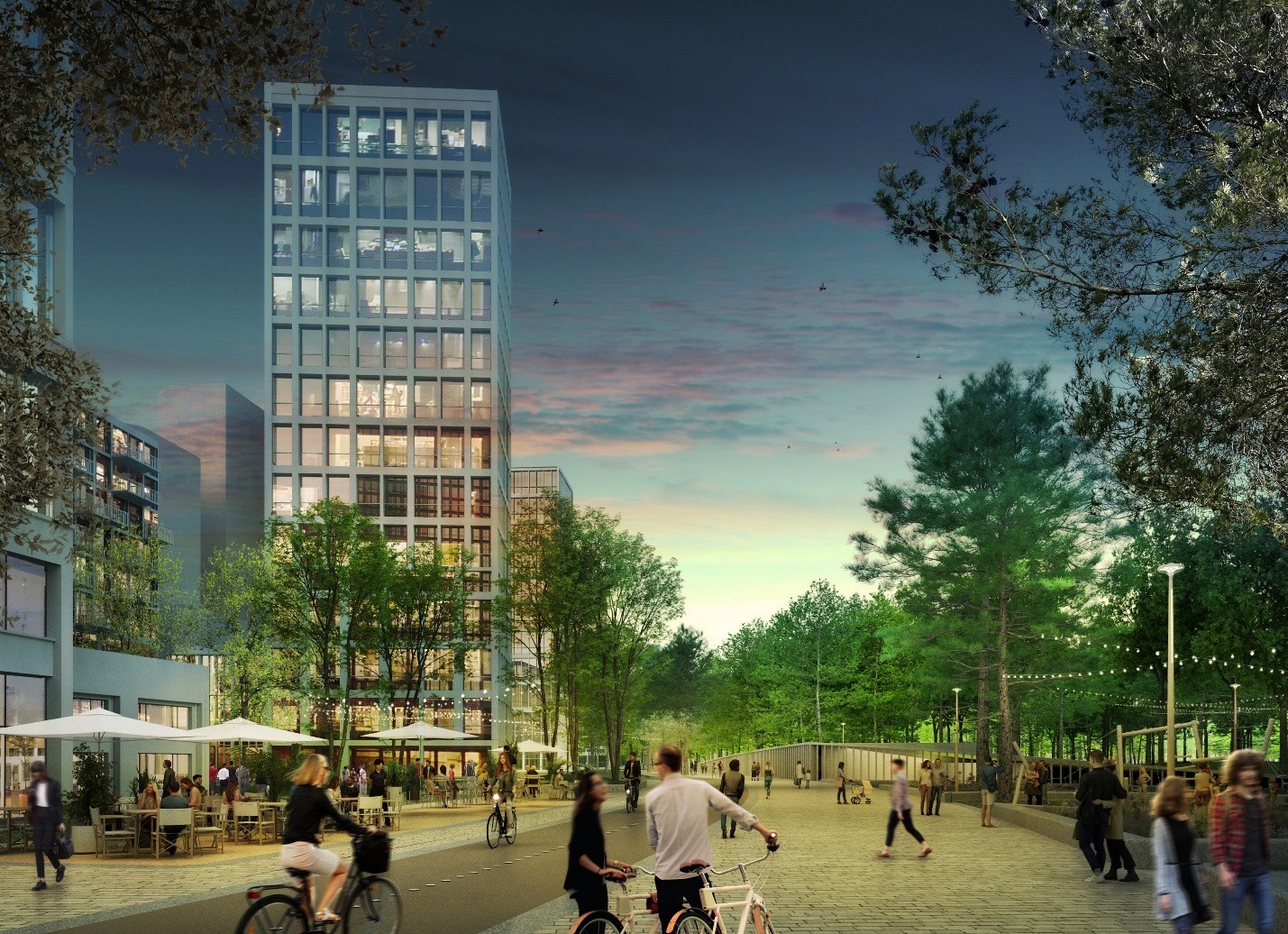
Madrid Nuevo Norte complements the proximity of everyday services and needs with a public transport network which is hyperconnected at both regional and national levels.
Along these lines, Madrid Nuevo Norte proposes to complement the idea of a 15-minute city, walkable and cyclable for everyday needs, with a “45-minute region”. This model is based on efficient and hyper-connected public transport, capable of facilitating access to employment, educational, cultural and leisure opportunities throughout the city and its metropolitan area.
But the project goes a step further and, thanks to the synergy between a first-rate centre of economic activity—as the future Central Business District will be—and the country’s main railway hub, Chamartín station, it even proposes a “3-hour country”, saving millions of urban trips by linking access to the city with the thousands of jobs which will be created. The model is so committed to this direction that the high-rise office buildings are not only next to the station, but even above it—something already seen in cities like Tokyo, in London’s The Shard or at Boston’s South Station in the United States—an approach which optimises mobility and drastically reduces the carbon footprint and the need for urban infrastructure.
This multi-scale approach connects with research developed by European universities, such as a study published in 2026 based on a comparative analysis of more than 90 cities, which shows that urban accessibility and social equity depend not only on everyday proximity, but also on efficient connection with the wider city and region.
In this way, the project helps to offer solutions to some of the great contemporary urban challenges: advancing towards the European Union’s emissions reduction targets, effectively promoting sustainable multimodal transport options, reducing road traffic and improving equity in access to transport and services.
Because, as Clarence Perry stated almost a hundred years ago, thinking about the city in terms of distances matters. But today we know that doing it well means looking from the doorstep to the neighbourhood, and from the neighbourhood to the city as a whole and the region which surround it.


